|
Directions: From the intersection of Hwy 25 and Academy (i83) on the south end of Colorado Springs continue 1.8 miles west to i115 South. Take i115 about 26 miles to 3rd street (at the beginning of the city of Penrose). A sign points you towards Brush Hollow Reservoir go right (west) on 3rd for two blocks then turn right on E street. Take E St. straight (do not follow the road to the right or left) for about 3 miles. You will have passed over two cattle guards by this time when you come to a metal sign on the left pointing you to the Independence Trail System. Turn left and go .2 miles to the large sign informing you about this trail system. After reading the sign go left down to the trail head. Camping is available all over the area and many fire pits have already been formed.
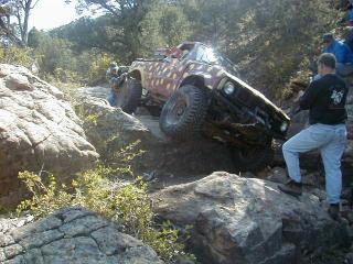
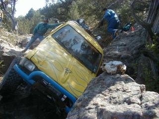
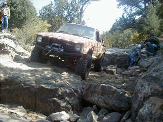
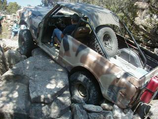
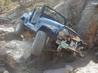
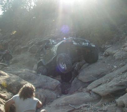
Patriot is a technically challenging trail to say the least. Although the trial is relatively short, about .8 miles, plan on spending 5 hours without breakage and much more with. Body damage and breakage is likely on this trail. Extra axles, tie rods, drive shafts, etc. are recommended parts to bring with you. You start out on the Independence trail that takes you down a steep hill and through several boulder fields for about 300 yards. At After making it through the Independence Trail leading up to the Patriot Trial you find yourself staring at a radical climb to the top of the canyon and your exit. The first obstacle can be run in several ways and seems to break axles like they are tooth picks. After the first obstacle you have a boulder field with a wedge in the middle. The wedge being two huge boulders that if not run properly will destroy your rocker panels trying to get over then.
Once past the “a-hole” you will traverse nearly 400 yards of difficult boulder field to get to the exit. The exit is a steep hill climb with several steps and many boulders to get over. This trail is a great challenge for the hard core wheeler that wants to test their skills. The real challenge comes with the fact that most of the major obstacles must be taken on a curve, causing you to take them at weird approach angles. |
Patriot – Colorado
Categories: